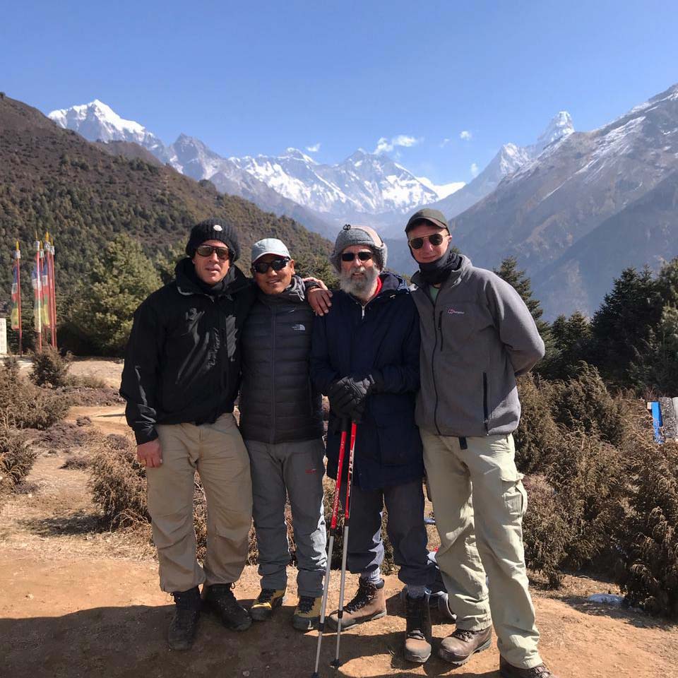
Day 1: Arrive in Kathmandu and meet at airport and transfer to the Hotel short briefing about the programmers. Overnight at Hotel
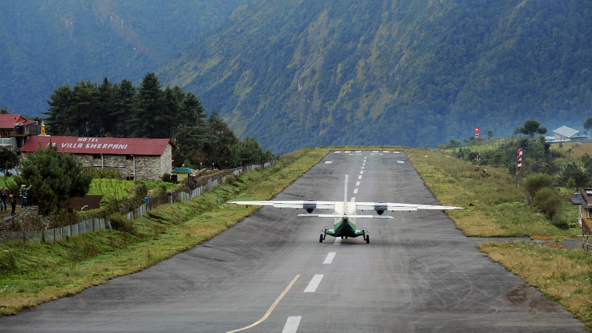
Day 2: Fly to Lukla then trek to Phakding (2665m) / (3 hrs walk)
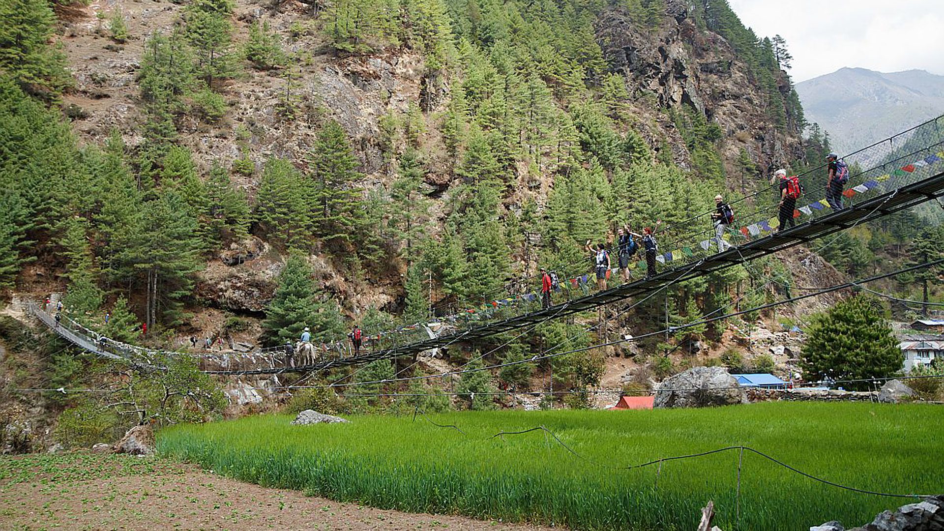
Today early in the morning leave to domestic airport from your hotel. It takes about 30min. flight to Lukla. At lukla meet with our porters and pre-pear our luggages then trek to Pkakding. Cross the Lukla village and continue trekking on the blank, and you will see open view with tarries field. Nice and easy walk today to Phakding. Nearby the hotel we have to cross Dudh Kosi River by suspension bridge. Nearby hotel Dudh Koshi River below getting closer to the right bank and the grassy space in front of the lodge will offer a comfortable campsite also. Overnight at lodge
Day 3: Trek to Namche Bazar (3440m) / 5.30 hrs walk.
Your destination today is Namche Bazar. From Phakding, trek through the pine and cedar woods, cross the Gatte khola flowing from the left, climb up on the plateau, and you are in Toktok which has five or six bhattis. The course goes further into the woods and leads you to a lodge. You are still in Toktok. Continue through the woods, overlooking the Dudh Kosi on your right, and Thamserku (6623 meters) will become visible shining white far in the valley. Flow the path on the sunny mountain flank, cross a small ridge, and you will reach Benkar which has about ten houses. Go through the village and cross over the suspension bridge to the left bank. The path will enter the woods and, after a little climbing you will see lodge. If you cross the stream, you will soon be in the village of Chuma. Continue on a little further, and you will reach Monjo. There is a check post at the village entrance, where they will check your trekking permit.
The path will go down to the bank of the Dudh Kosi and cross over a suspension bridge. You will soon come to Jorsale with four or five lodges. It will be about time to have lunch. After passing through the village, you will cross another suspension bridge back to the mountain flank covered with woods. Cross the suspension bridge over the Dudh Kosi. Below, to your left, the tributary Bhote Kosi joins in. It came from the border pass Nangpa La (5,716 meters) via Thame. From here starts a 6000 meter climb to Namche Bazaar. Zigzag up the mountain flank, and you will Topdada, the bridge with a bhatti. You have finished half of the climb and you can see Everest for the first time in this course. The last half of the climb will go through the conifer woods. Shortly after you start seeing the mountains of Rolwalling Himal, some white- walled houses will come into sight. You have reached Namche Bazzar (3446 meters).
Namche Bazar is the central village of the Sherpa’s in the Khumbu region. It is situated on a horseshoe shaped flank and is crowded with about 100 buildings including lodges, Vhatties (means small tea shop), there are many stores, banks, internet café, snooker house, bakery shop etc. There is a plateau on the right side of the village entrance, where they have a bazaar every Saturday. It is thronged with people especially in the morning. Overnight at lodge
Day 4: Acclimatization at Namche bazzar: Day hike
Today we shall visit to Sayanboche, Everest view hotel and Khumjung village for nice Mountain View and for Acclimatization. We can see open spectacular Everest view from Hotel which is run by Japanese owner. Overnight at Namche Bazzar Lodge.
Day 5: Trek to Tengboche / Deboche 3860m. / 5.30hrs walk
Today,s Course to Tengboche will first go down about 250 meters to the Dudh Kosi bank and climb up about 670 meters. It is tiring and you may start showing symptoms of altitudes sickness. You are advised to pay attention to your physical condition and to be cautious about your actions.
First, climb the east flank of Namche Bazar, and you will come to a cool called Choking. On the way, there is a check post where they will check your trekking permit. Chokong is level. The Dudh Kosi is far down below to your right and you will see Thamserku, Kantenga (6799 meters), Ama Dablam (6812 meters), Lhotse, and Everest in front of you. This spot is overwhelmingly beautiful.
The path on the flank meanders down towards the valley. The Hotel Everest View can be seen on the hill above. Stay on the path for a while enjoying the view of Everest and other mountains, enter the rhododendron forest, and you will soon come to Sanasa, where the path forks into three. The left fork will lead to Khumjung, Khumde, and the Hotel Everest View. The center one that climbs the steep flank goes to Gokyo via Moung La (4140 meters). Take the right one to Mt. Everest B.C.
From the front of the lodge in Sanasa, trek down the mountain flank, pass Trashinga into the woods, and you will be on the shores of Dudh kosi. Cross the suspension bridge to Phunki Tenga (3190 meters), where you can have a lunch break.
The path of Tengboche will first climb up a steep slope and the woods. Once you are on the sunny mountain flank, the slope becomes gentler. Follow the path on the right side flank of the ridge, go up on the plateau, and you will reach Tengboche (3990 meters) with Gompa. Every year in the October, when the moon is full, Mani Rimdu, which is a Tibetan Buddhist dance- drama of 14 scenes, is held in this Tengboche Gompa. Overnight at lodge
Day 6: Trek to: Dingboche 4350m. / 5hrs walk
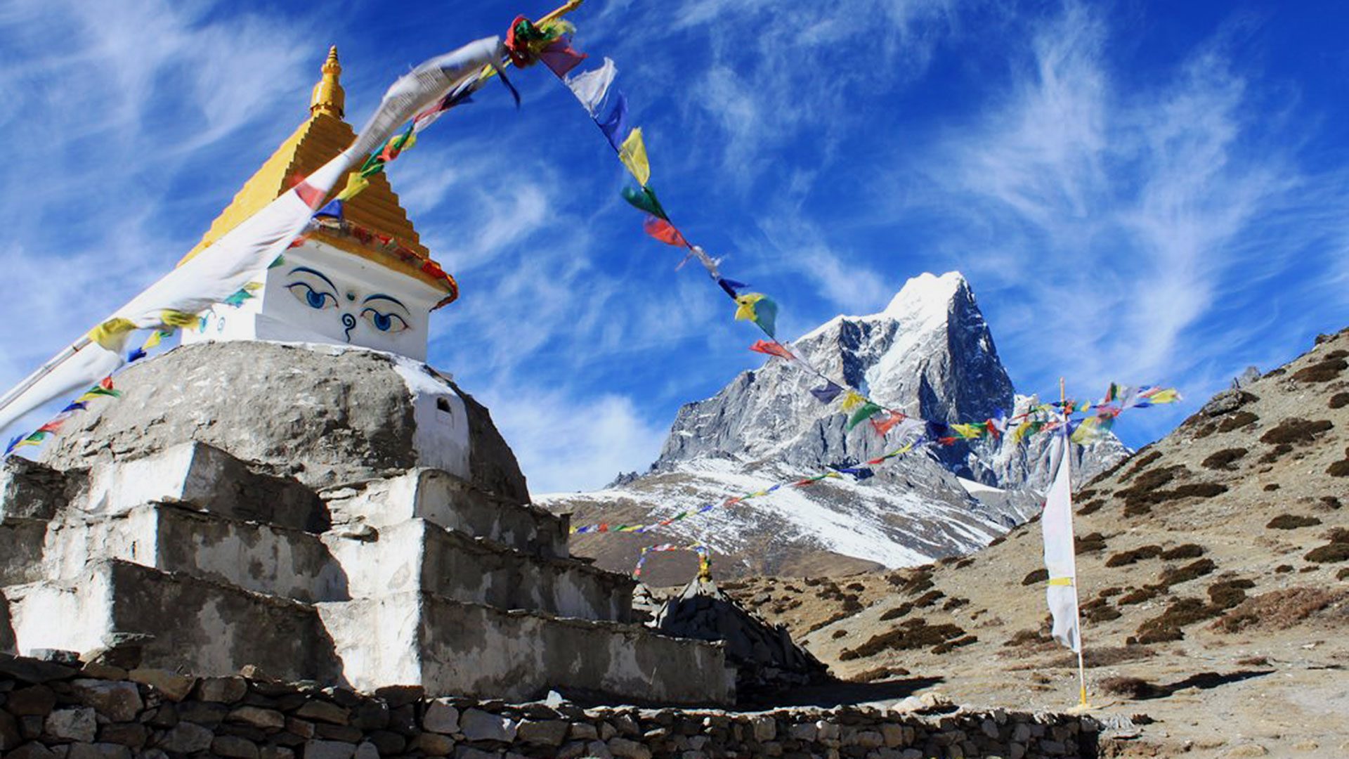
Today's journey is as far as Pheriche. From the northern end of Tengboche plateau surrounded by rhododendrons, trek down the stone steps, and you will come to Deboche which has an atmosphere of a garden surrounded by cedars. A little after passing the next Miringo village, cross the tributary Imja Khola using the suspension bridge, from the flank on the right bank, the path becomes rocky and you will come to a chorten. Go through the Kanni and go up on the mountain flank on the left. The upper fork goes to the lower village with a gompa and the lower fork to the lower village. Pangboche is the remotest inhabited village on Imja khola and there are no villages past this one. The other place that looks like a village is a kharka or a pasture for summertime.
The path from the upper and the lower village of Pangaboche meet at the edge of Pangaboche. If you climb up along the Imja Khola, you will come to the kharka in Shomare. Further ahead, there will be a place where a part of the flank is collapsed. Before long, you will come to Orsho which has a house on the hill and, after about 15 minutes trekking on the hill, you will arrive at the Kharka in Tsuro. The path fork into two. The fork that goes straight along the river is the keadub ti Chhukung via Dingboche.
In order to go to Peruche, climb up the left side flank onto the pass. In the wide valley ahead, you will see a Kharka with a stone wall around it. Trek down to the stream, cross it, and you will reach Pheriche (4215 meters). There are several lodges and a Tokyo Medical university clinic, within which there is a Trekkers Aid post run by the Himalayan Rescue Association. This post will give you a sense of security since altitude sickness symptoms often appear on approaching Pheruche. But today we are going to Dingboche which is open view and nice village.
It is indispensable to fully adjust your body to the high altitude before advancing to Kala Pattar and Mt. Everest B.C. if necessary, be ready to plan for a few days of acclimatization.
On the mountain flank behind the lodge, a path is seen clearly going up to the right. It leads to Dingboche. If you follow it, you will come to a pass with chorten and you can see Dingboche down below. And it can be an enjoyable hiking course for acclimatization. Trek further in to the valley. The path will remain level for a while. After passing the kharka in Phulong Karpo, the valley turns to the right and the course, too, accordingly. As you go up the valley, you will come to a point where the valley branches off to the felt. The path along this branch valley passes through the glacier lake Tshola Tso, crosses over Tshola La (5420 meters), and leads to Gokyo. It is a hard course.
To go to your destination Lobuche, climb the mountain flank. The path will meet another that comes from the right side. It is a trail from Dingboche. Ahead of this point, cross the stream flowing from the Khumbu Glacier and you are in Thukla it will be time for lunch. Overnight at Lodge.
Day 7: Dingboche Aclamataization….
Day 8: Trek to Lobuche 4930m / 3.30 hrs walk
Today we shall Trek further in to the valley. The path will remain level for a while. After passing the Kharka in Phulong Karpo, the valley turns to the right and the course, too, accordingly. As you go up the valley, you will come to a point where the valley branches off to the felt. The path along this branch valley passes through the glacier lake Tshola Tso, crosses over Tshola La (5420 meters), and leads to Gokyo. It is a hard course.
To go to your destination Lobuche, climb the mountain flank. The path will meet another that comes from the right side. It is a trail from Dingboche. Ahead of this point, cross the stream flowing from the Khumbu Glacier and you are in Thukla it will be time for lunch.
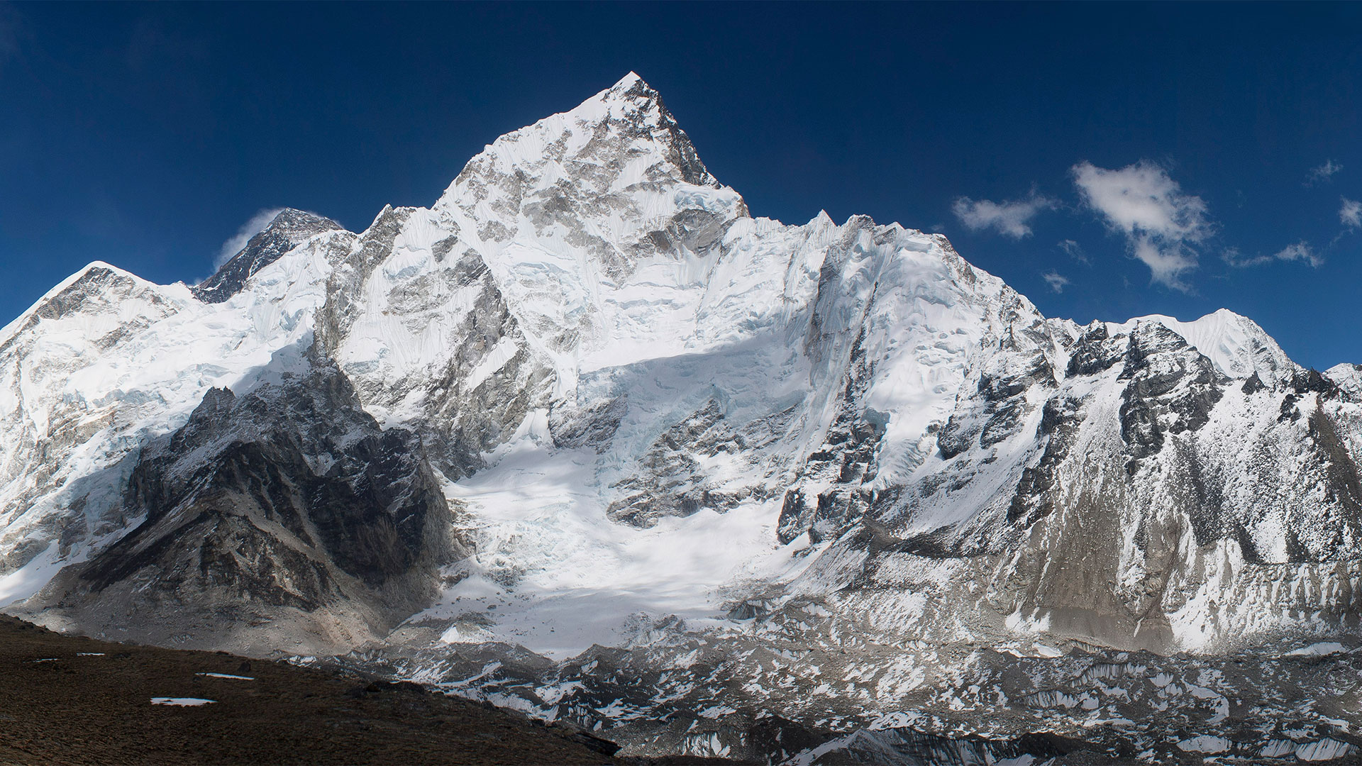
After Lunch walk to the gentle climb up to what you see up ahead is the end moraine of the Khumbu Glacier. The steep ascent of about 250 meters from here is very tough for everyone .Zigzag up the slope with all your strength, and you will be standing on the pass, from where you will see ahead of you many tombstones of those who lost their life there. Now, go through the gulley of the glacier on your right. Cross the stream, and you will reach Lobuche (4930 meters), looking straight up at Nuptse. There are several lodges and the campsite is the flat space in front of them. The elevation is almost 5000 meters and it becomes very cold at night. You may not be able to sleep well. Say special attention to your physical condition. Overnight at lodge
Day 9: Trek to Gorakshap 5170m / 2.30hrs walk
It is only a half-day journey from Lobuche to Gorakshep but it is hard trekking due to the high elevation of 5,000 meters. First, trek along the stream in the ablation valley, and Pumori, 7161 meters, will become visible in front of you. From its summit, a snow ridge is stretching towards you and changes into a dark brown hill. That is Kala Pattar, a lookout Point at 5545 meters. If you turn around, you will see Taw-tse (6501 meters) and Cholaste (6440 meters), shining their snow-clad Peaks beyond the hills.
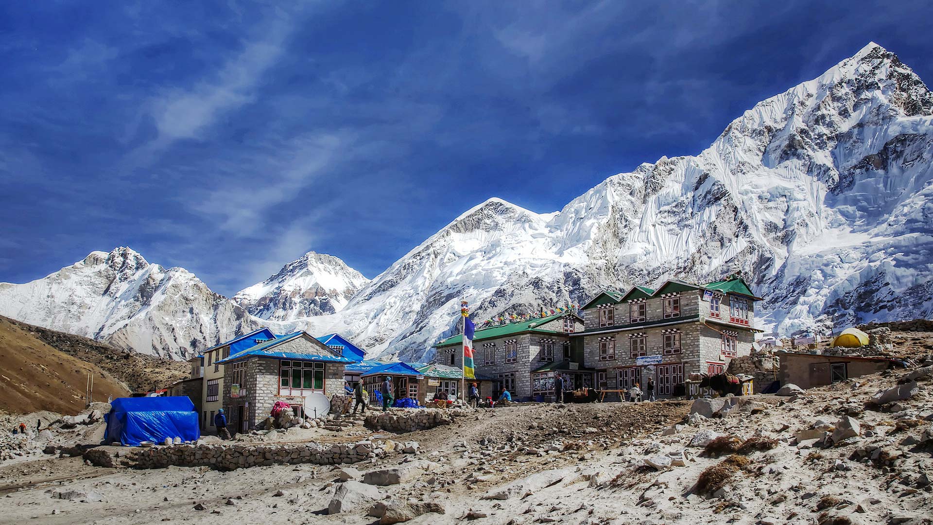
The path will soon start climbing up the side moraine of the Changri Glacier. The climb up to the top of the moraine covering the height of about 150 meters is very hard, but the rest is just to cross the Changri Glacier that joins the Khumbu Glacier. When you reach the opposite side of the glacier, you will over look the Gorakshep glacier lake and three lodges with wide barren sand in the front. Trek down the slope of screen for about 10 minutes, and you will find yourself in front of the lodges. The campsite can be anywhere around them. The elevation of Gorakshep is 5100 meters.
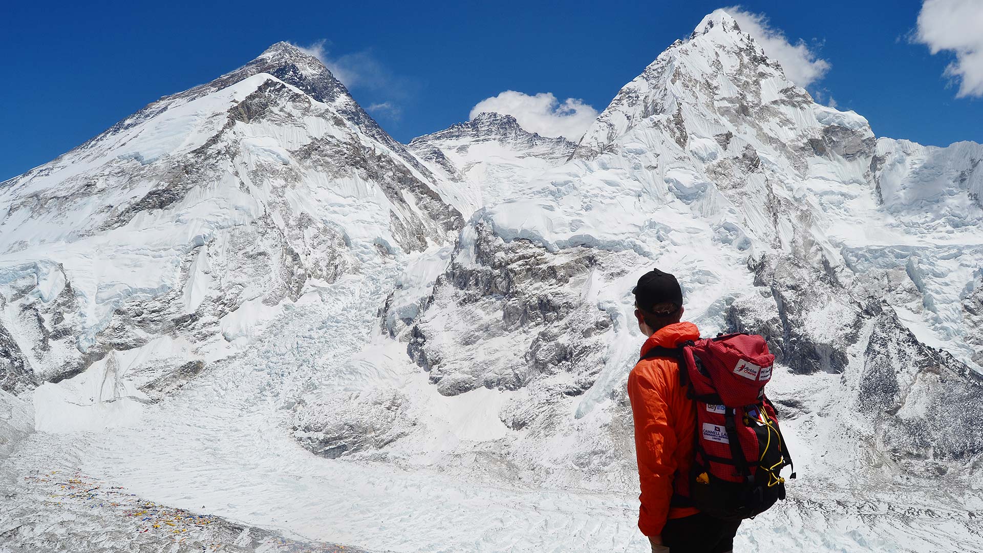
If you have strength left, climb up to Kala pattar in the afternoon. It takes about one hour and a half. You can enjoy a 360 degree view and Mt. Everest at dusk, which is beautiful beyond description. It is not an exaggeration to say that the main purpose of taking this course is to fully enjoy the view from Kala Patthar.
There are two routes to reach Kala Patthar. The direct route is to climb the flank and the other is to climb the ridge line route leading from the sandy area to the ridge end. Either route will take about the same amount of time. If you plan to stay on the lookout until evening, do not forget to take a lamp and gear for the cold. Overnight at lodge
Day 10: Trek to Everest Base Camp (5364 m (3.30 hrs and 2.30rs back) to Gorkshep
Today's journey is an around-trip to Mt. Everest B.C. Pass by the glacier lake, which supplies water for Gorkshep. Go through the side moraine, and sand and you don’t feel like you are walking on a glacier. As you follow the course, repeating small ascents and descents, you will start trekking through glacier tables with a cloister of ice spires on your left. You will now realize that you are in the midst of the glacier.
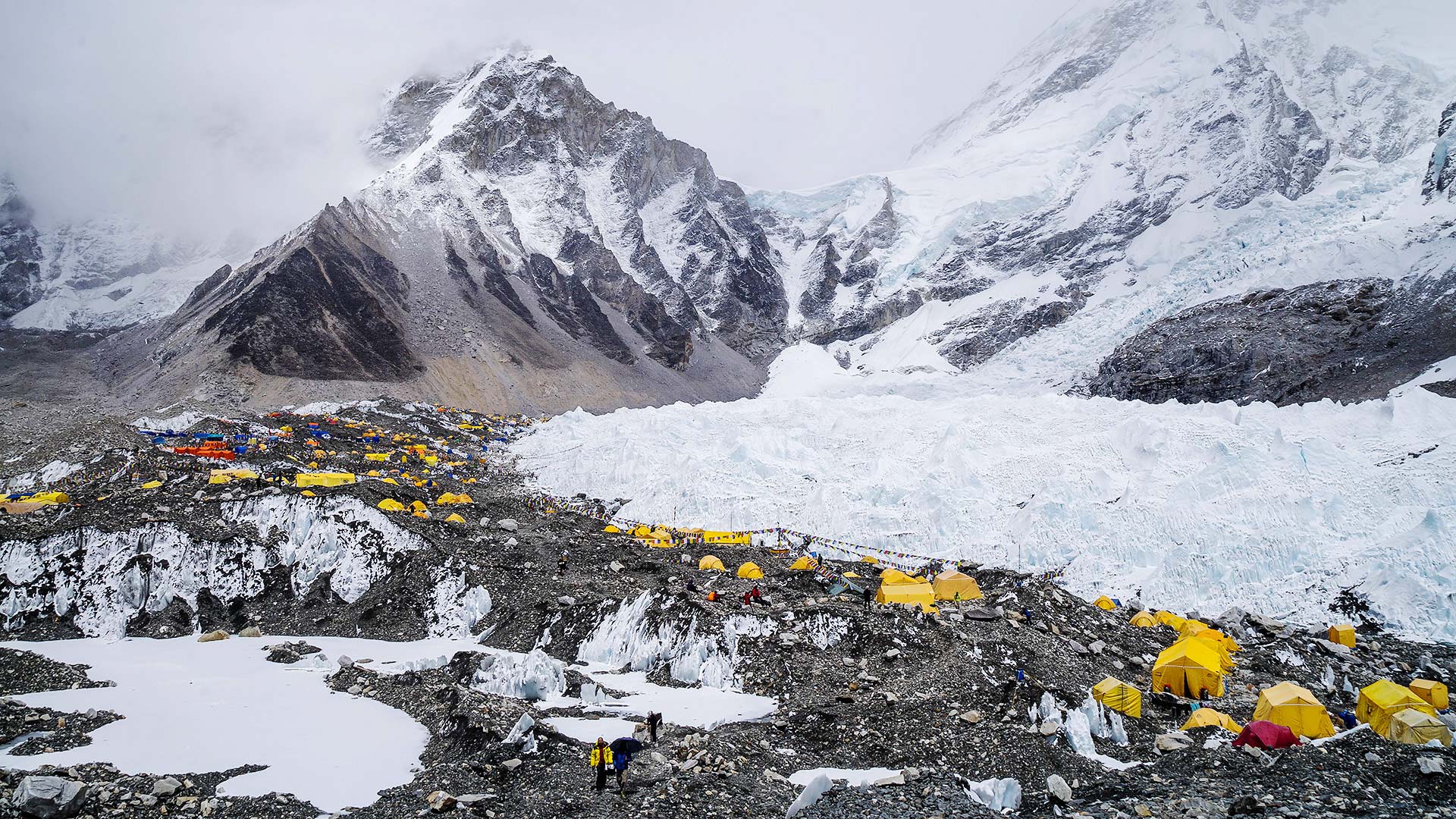
Before long, you will pass by another group of ice spires, this time on your right. Continue climbing towards the end of these ice spires, and you will reach Mt. Everest B.C., which looks desolate surrounded by ice, snow, and rock faces. South Col (7986 meters) and the icefalls of the west can be seen from this place. Many climbing Parties use this base camp to climb Mt. Everest. The place is often full of tents and Presents a unique atmosphere. The summit of Everest cannot see from this base camp. We advised not to stay here a long time to avoid getting altitude sickness. It takes about two hours to go down from the base camp to Gorkshep. Overnight at lodge.
Day 11: Trek to Kakalapather (5545m) then trek back to Pheruche 4250m.
This morning we shall have start early in the morning at 5 am. For sunrise view to Everest, Lotse, Nuptse and others to the right and Pumori in the left. It will take to reach at summit about 2.30 hrs. Make photograph and then back to same lodge take breakfast then start trek same way back to Pheruche via Lobuche. Overnight at Lodge.
Day 12: Trek Kayang (5/6hrs walk) same way back through Tengboche Monastry. Overnight at lodge.
Day 13: Trek back to Manjo 2800m or Phakding (5 hrs walk) Same way back through Namche bazzer. Overnight at lodge
Day 14: Trek back to Lukla (4.30hrs walk) Overnight at Lodge
Today we shall have made last night party here with porters.
Day 15: Fly back to Kathmandu and transfer to the hotel and free afternoon. Overnight at Hotel.
Day 16: Free and shopingn day in Kathmandu
Day 17: final departure to and safe fly back to home.


